Central Cascades snow pits

On this page you will find graphs of snow pits that were created by Willamette Pass Ski Patrol in the local area. Some pits are from inside the ski area boundary and some are from other places we like to ski. Since there is currently no avalanche forecasting data available for the areas between Mt. Hood and Crater Lake we have created this page to provide a source of information for backcountry travelers. This page is for informational purposes only! We are not avalanche forecasters and do not claim to have information that should substitute for your good judgement. Backcountry travel can be dangerous and you are responsible for ensuring your own safety.
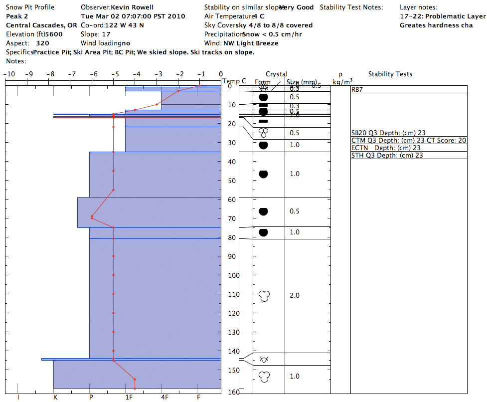
The graphs on this page were made using Snowpilot http://snowpilot.org/ software which is available for free and is easy to use. We would appreciate seeing snow pit graphs made by other backcountry travelers in this area. Use the Contact Webmaster link at the bottom of this page to reach us. More data is a good thing! To understand the grain types, hardness and stability test notation you will need some basic avalanche awareness training. We recommend an avalanche class and/or self study.
Be safe!
Snow pit profiles:
Click on a image to enlarge |
|
 |
Tuesday, March 2, 2010 


|
 |
Monday, February 22, 2010 


|